Need a quick quote? Contact us at +33 1 77 23 36 83
CREATION OF PLAN AND DIGITAL MOCKUP

2D AND 3D PLAN PROJECTION (BIM)

2d-and-3d-plan-projection

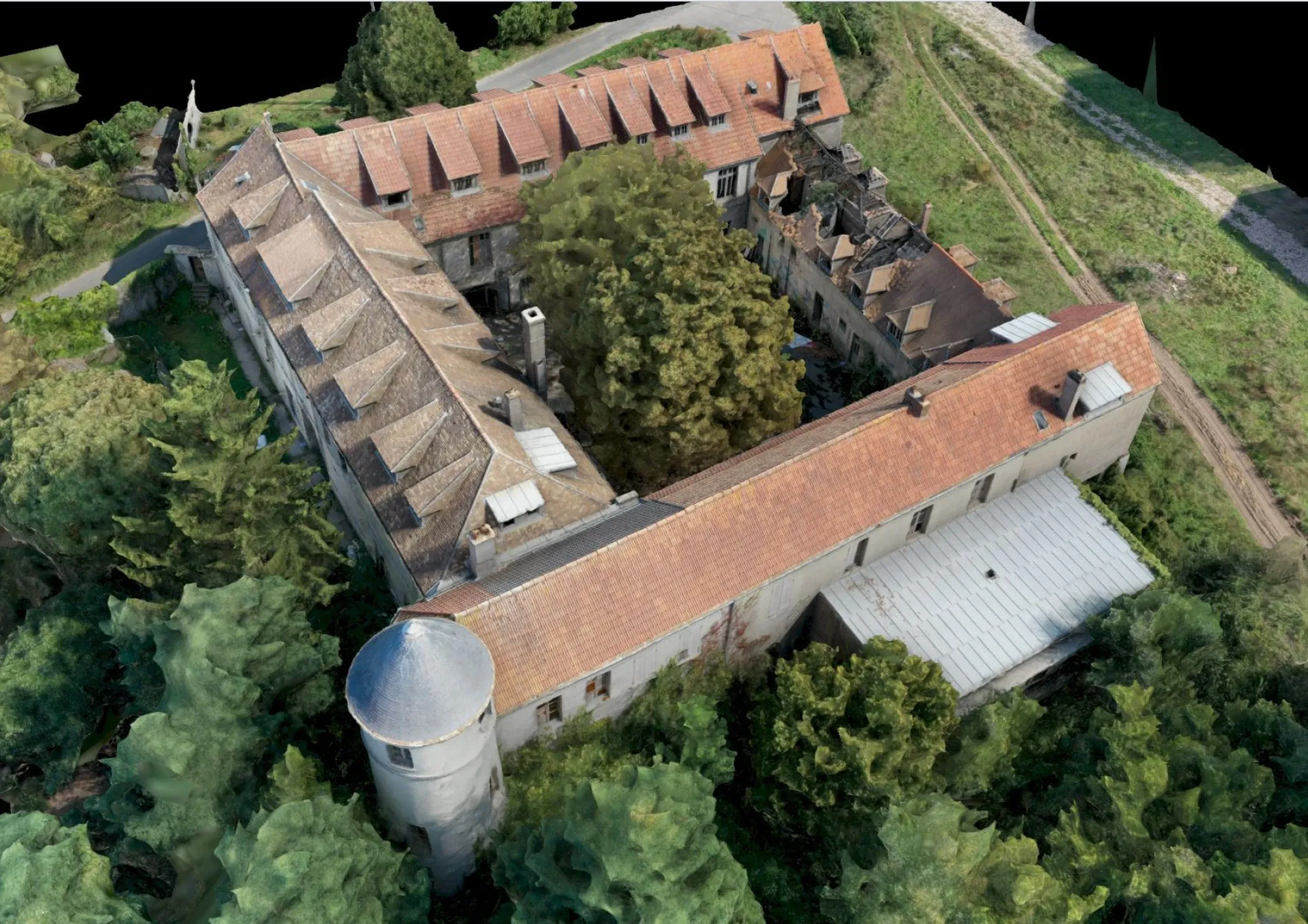
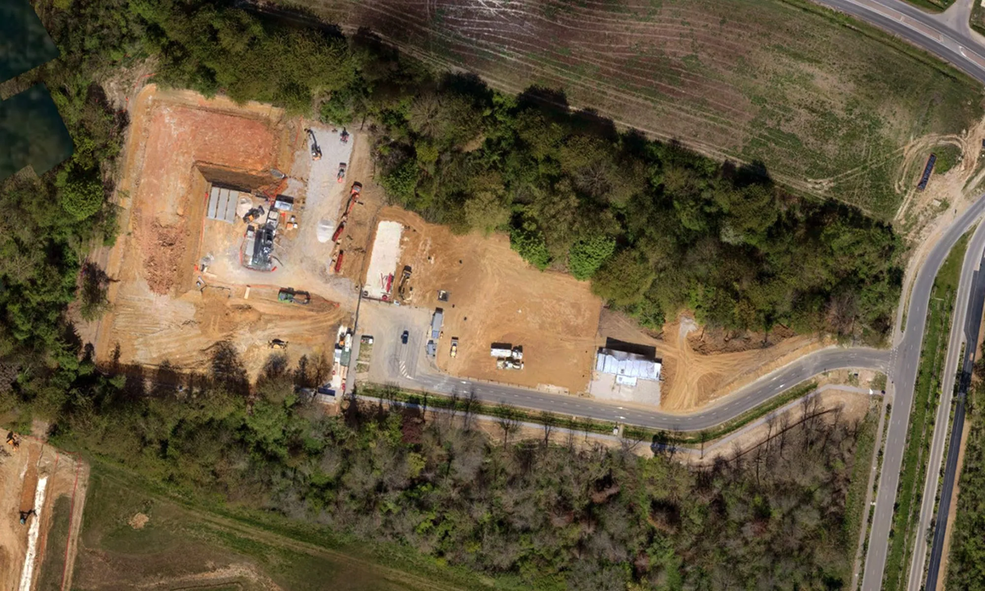
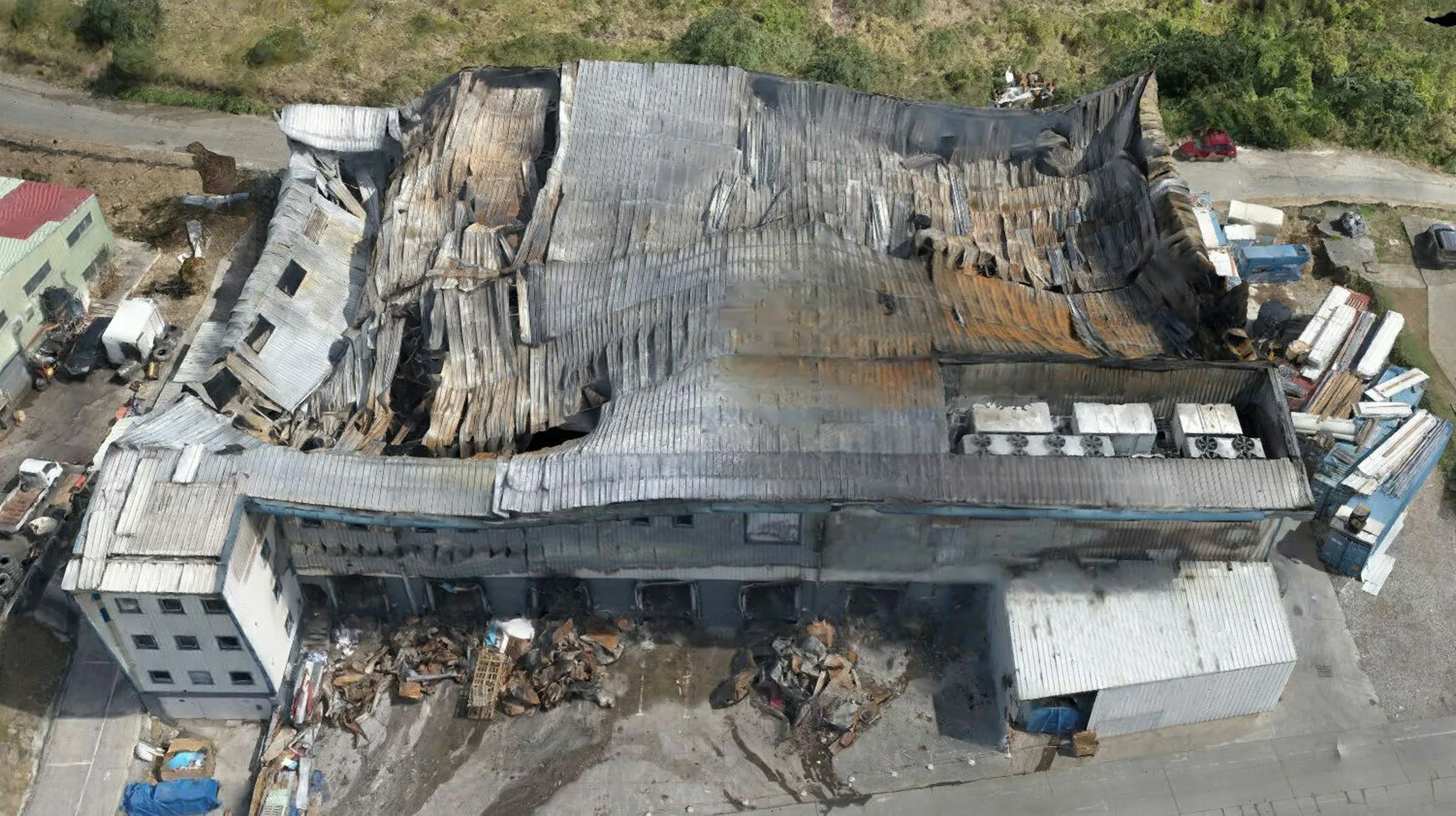
Create or recreate your plans from aerial and/or ground-based laser imagery for your construction or renovation projects.

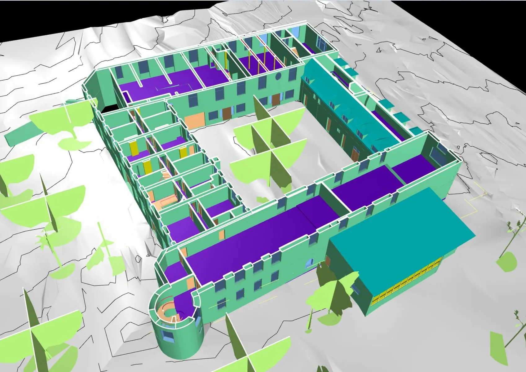
BIM solutions for optimized management

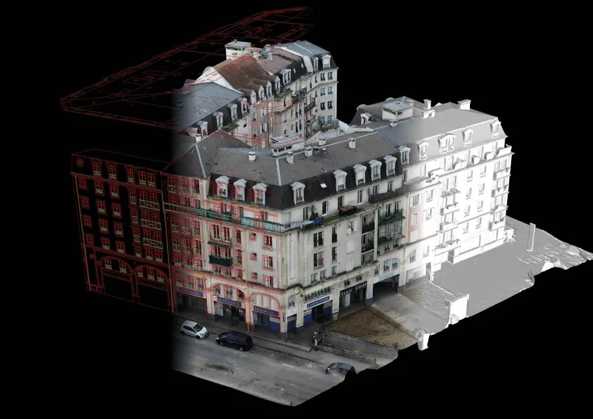
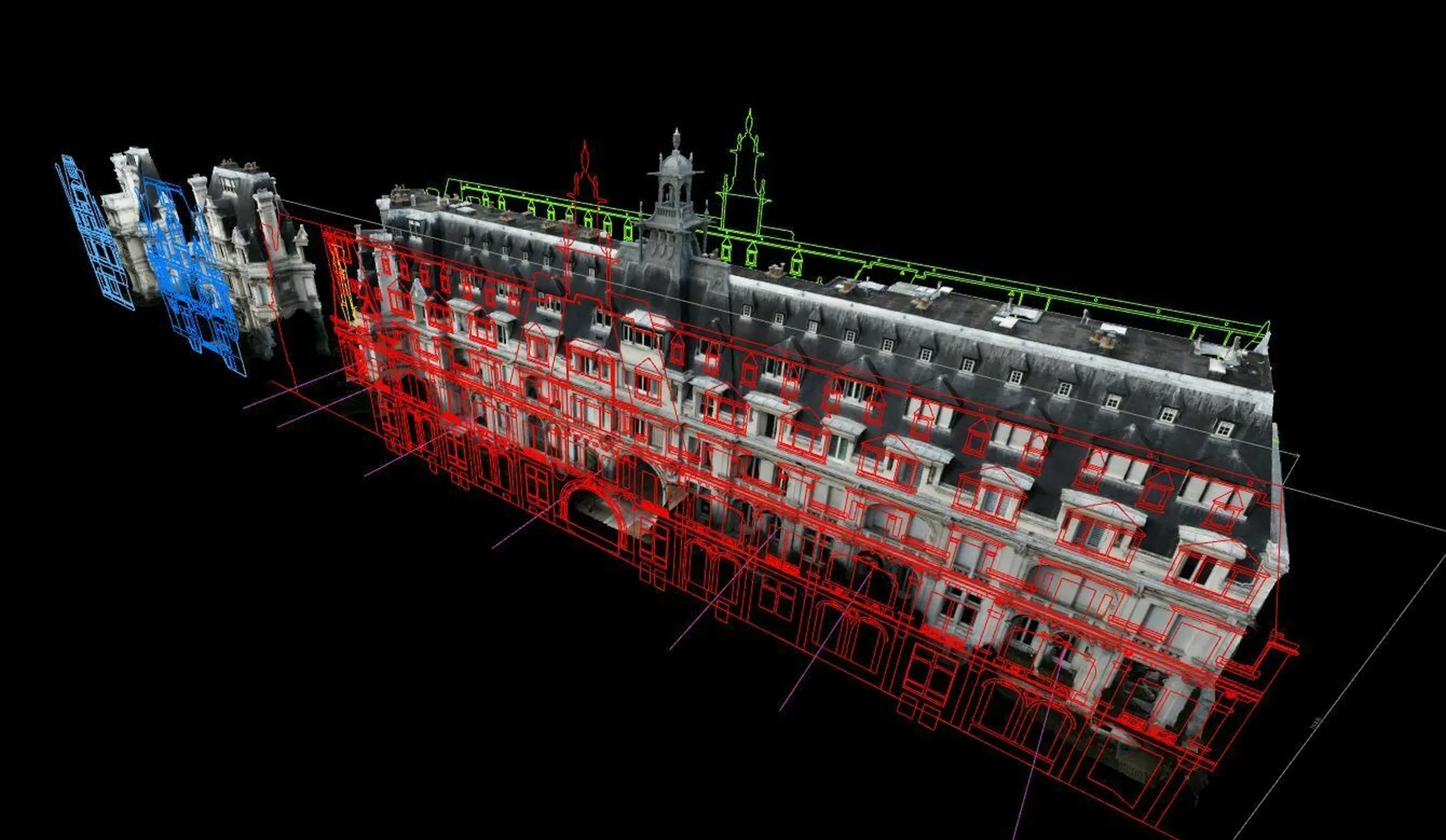
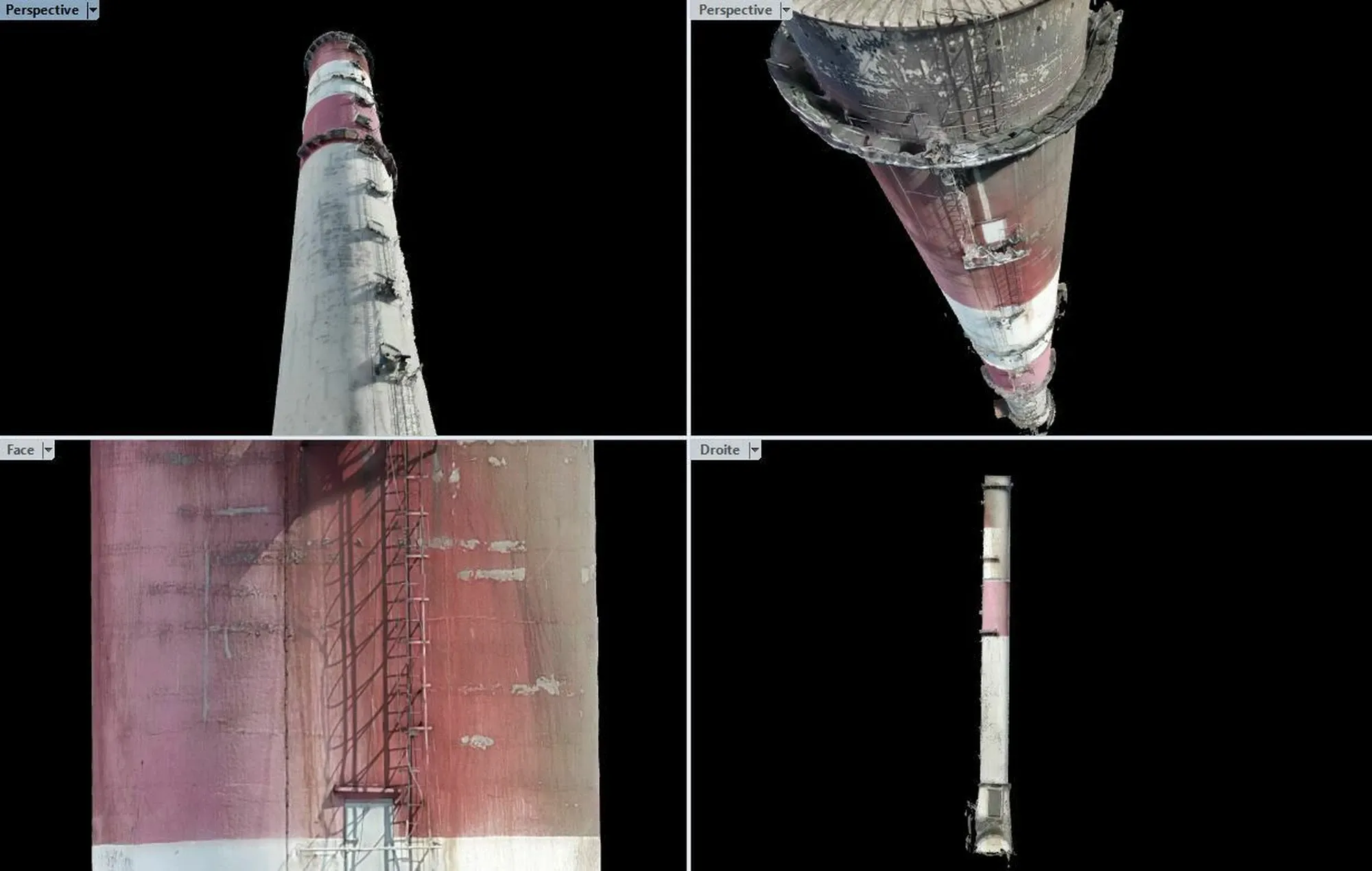
BIM (Building Information Modeling) is an essential tool for new construction or renovation projects. Thanks to precise surveys carried out by drone or 3D scanner, we produce 2D plans and 3D models (LOD 100 and 200) adapted to your needs. These services allow you to quantify linear dimensions, estimate surfaces, and create scaled orthophotos. Our solutions can also be used to create pre- or post-construction plans, as well as virtual tours accessible online.

Topics that may interest you
See more
>
INDUSTRIAL INSPECTION

Aerial drone imaging and 3D scanner digitization are fast, safe, and effective solutions for inspections in industrial environments, reducing production downtime and ensuring worker safety.

DISCOVER
DRONE-BASED CONSTRUCTION SITE MONITORING

Track, control, and archive the progress of your construction sites with our collaborative drone and 3D scanner tracking solutions.

DISCOVER
POST-DISASTER EXPERTISE

Dronotec has been operating since 2014 with hundreds of missions carried out in France and Europe, providing technological solutions for post-disaster assessment.

DISCOVER
GET YOUR QUOTE NOW
A CUSTOMIZED STUDY IS CARRIED OUT FOR EACH CASE
GET MY QUOTE
DO YOU HAVE A QUESTION?
WE WILL ANSWER YOU
Does Dronotec only operate in France or does it offer
services internationally?
How long does a drone inspection
intervention take on average?
What needs do Dronotec services address?
ACCESS THE F.A.Q
Thank you! Your message has been sent!
Oops! Something went wrong while submitting the form.