Anticipate risks with drone mapping and 3D digitization, essential tools for the prevention of natural, industrial, and technological risks.
Prevention and simulation tools
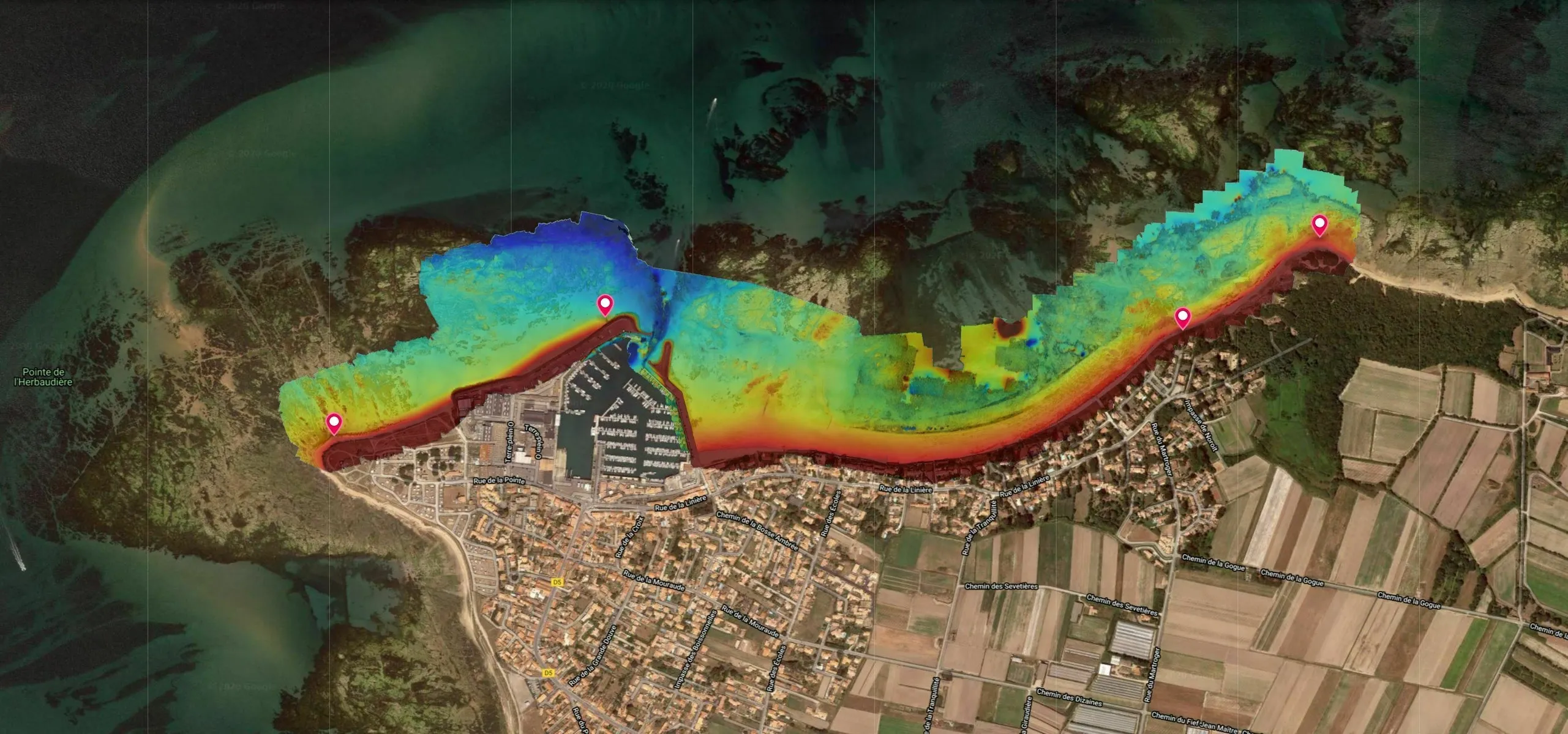
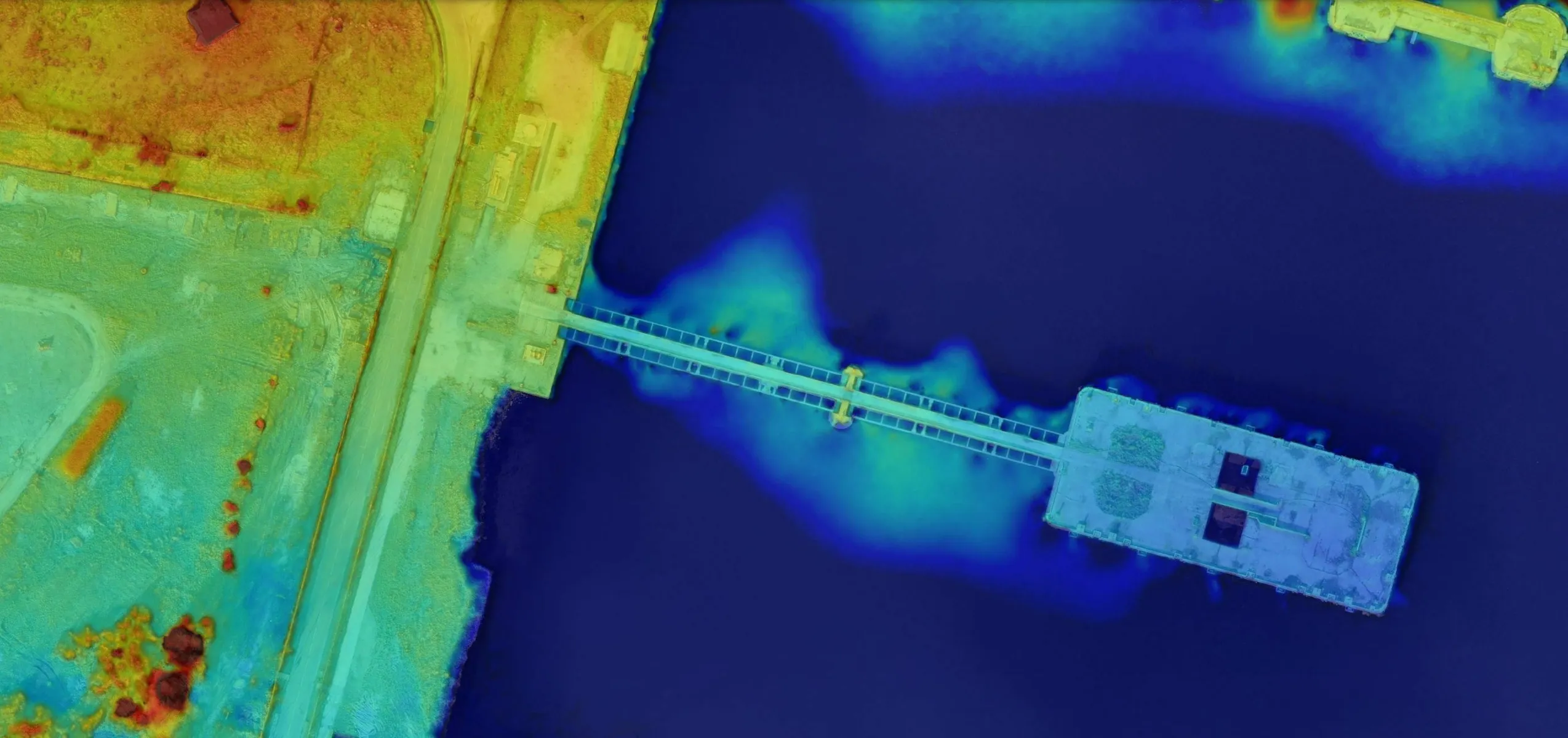
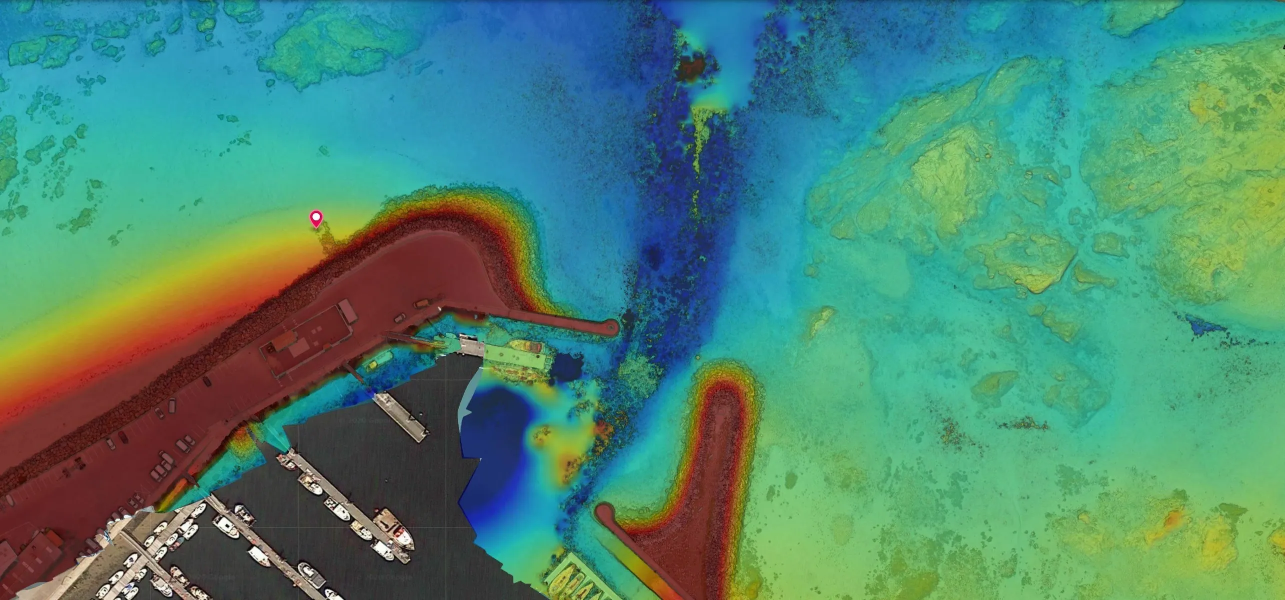
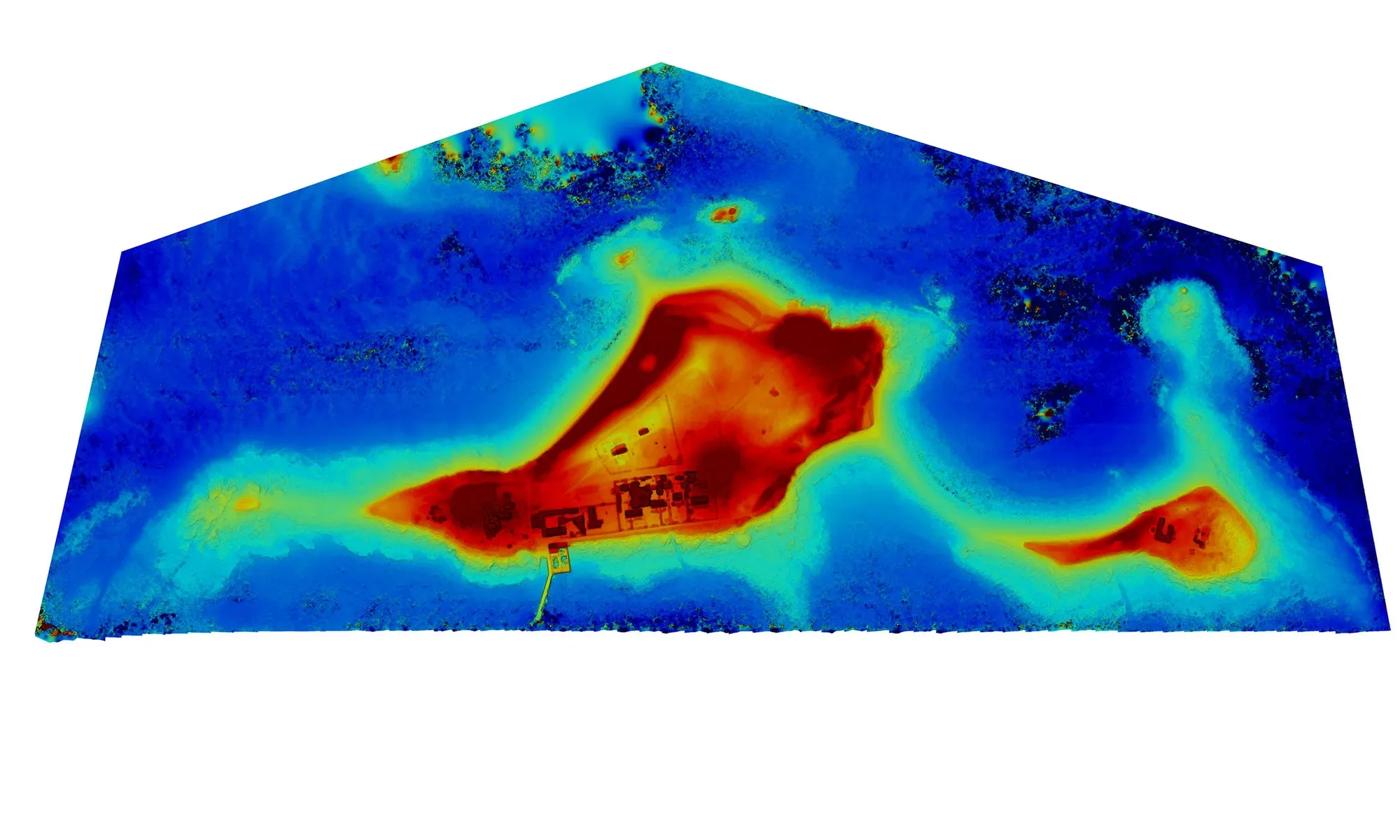
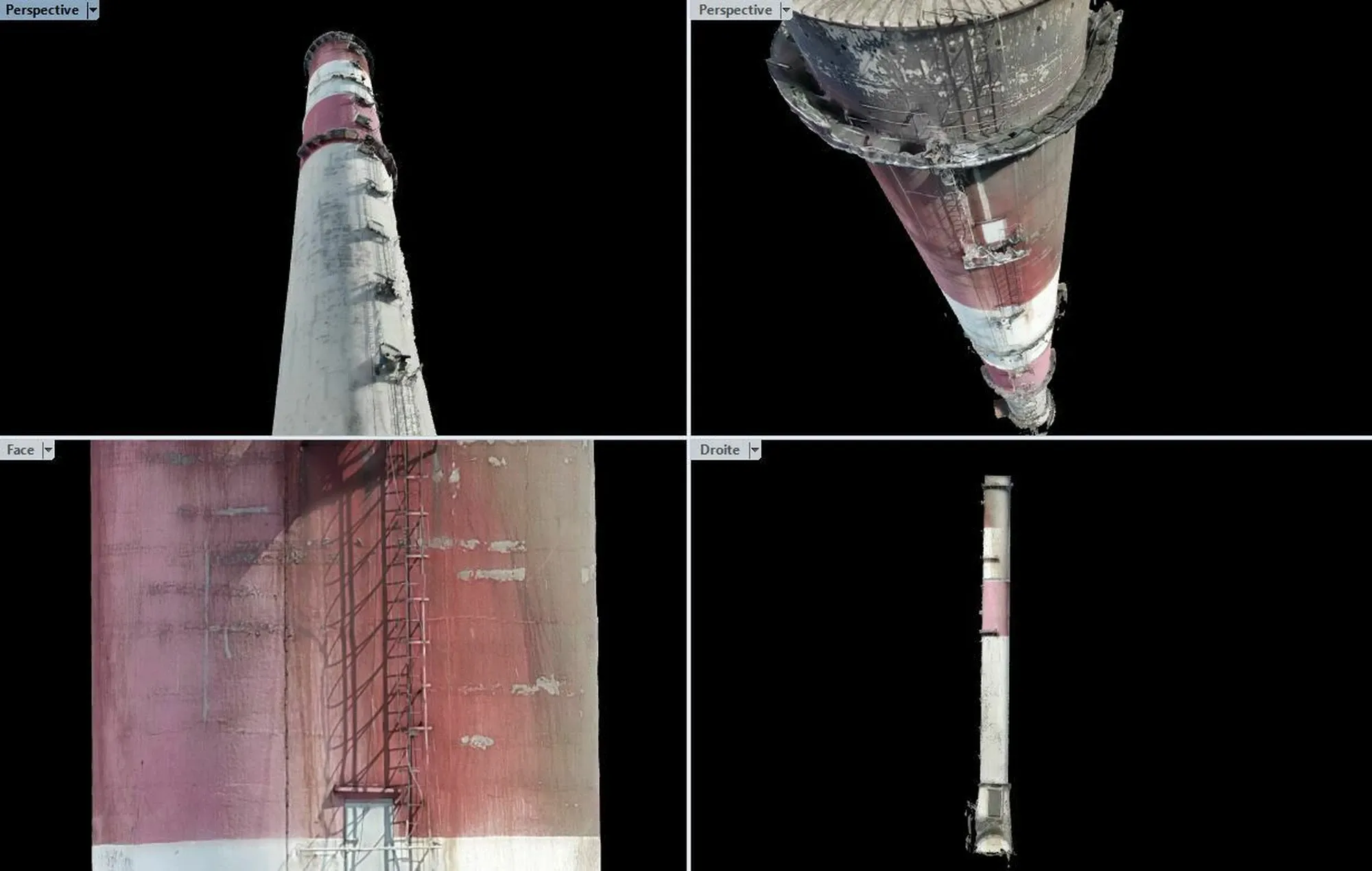
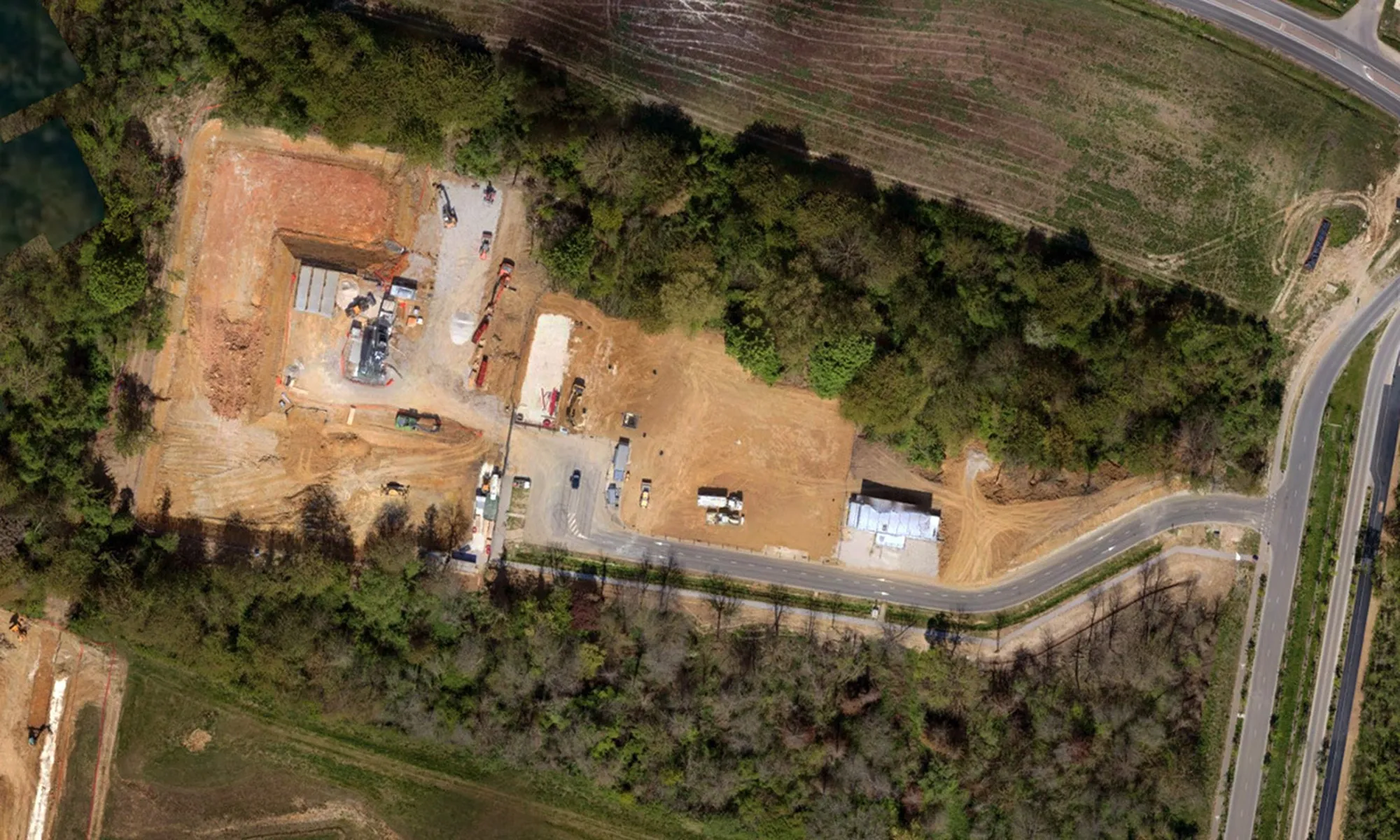
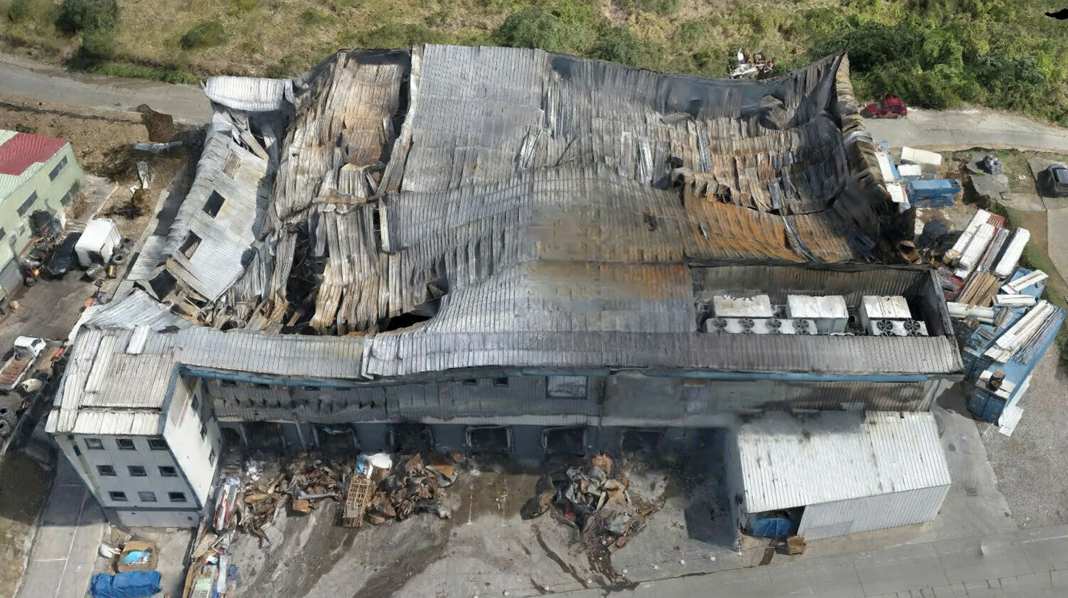
Dronotec offers mapping and modeling solutions to visualize and assess risks such as floods, erosion, or fire propagation. From the surveys, our teams produce digital twins and precise deliverables: topographic studies, GIS integration, meshes, and point clouds. This data can be used for disaster scenarios or prevention plans, facilitating the management and security of territories and infrastructures.